



Kootenay National Park is the Rockies park most Banff visitors drive right past. It starts about 30 minutes west of Banff, right on the Alberta–BC border, and packs a narrow limestone canyon, rust-orange mineral springs, and a hot springs pool into one scenic highway.
This guide covers the best things to do in Kootenay National Park, the hikes worth your time, when to go, and how to plan a Kootenay National Park trip from Calgary or Banff. Planning more of the Rockies? Our Icefields Parkway tour guide pairs well with it.
Is Kootenay National Park Worth Visiting?
Yes. The park is worth visiting if you want big Rockies scenery with short, easy walks right off the highway. Marble Canyon, the Paint Pots, and Radium Hot Springs all fit into one day from Banff, and serious hikers can tackle Stanley Glacier, Floe Lake, and the multi-day Rockwall.
| Kootenay at a glance | Details |
| Location | BC side of the Continental Divide, next to Banff and Yoho |
| Main road | Highway 93 South (Banff-Windermere Highway) |
| From Banff | About 30 minutes to the park boundary |
| From Calgary | About 2 hours to the park boundary |
| Best for | Canyon walks, day hikes, hot springs, scenic drives |
| Prime hiking season | July to mid-September |
| Visitor services | May to mid-October (park open year-round) |
Where Is Kootenay National Park, Canada?
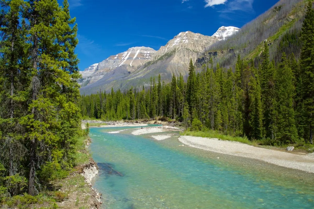
Kootenay National Park, Canada sits in the East Kootenay region of southeastern British Columbia. Highway 93 South runs through the middle of it, linking Castle Junction in Banff National Park with the village of Radium Hot Springs at the park’s southwest edge.
It’s one of four national parks that touch each other along the Continental Divide, with Banff to the east and Yoho National Park, Canada, to the north. Our Yoho National Park guide covers that side of the border.
Best Things to Do in Kootenay National Park
If you’re short on time and wondering what to do in Kootenay National Park, here are the top stops in order, driving south from Banff.
1. Stand on the Continental Divide
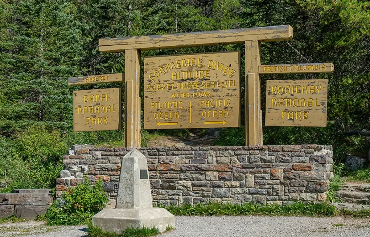
The first pullout marks the line between Alberta and BC and between rivers that flow to the Pacific and the Atlantic. The short fireweed loop here walks through a forest that burned in 1968 and is still regrowing.
2. Walk Marble Canyon
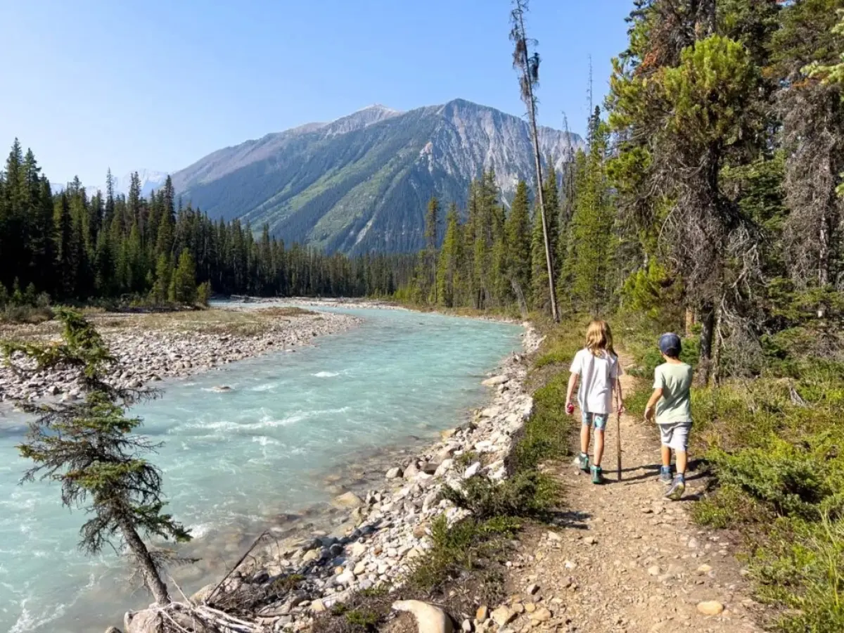
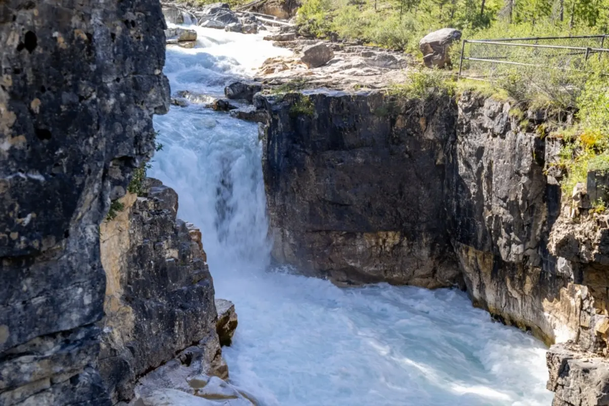
Marble Canyon is the park’s star attraction. The trail follows the rim of a deep, narrow gorge carved by Tokumm Creek, with bridges that look straight down into the rushing water. It’s under 1 km each way, and a pair of Parks Canada Red Chairs waits at the end.
3. See the Paint Pots
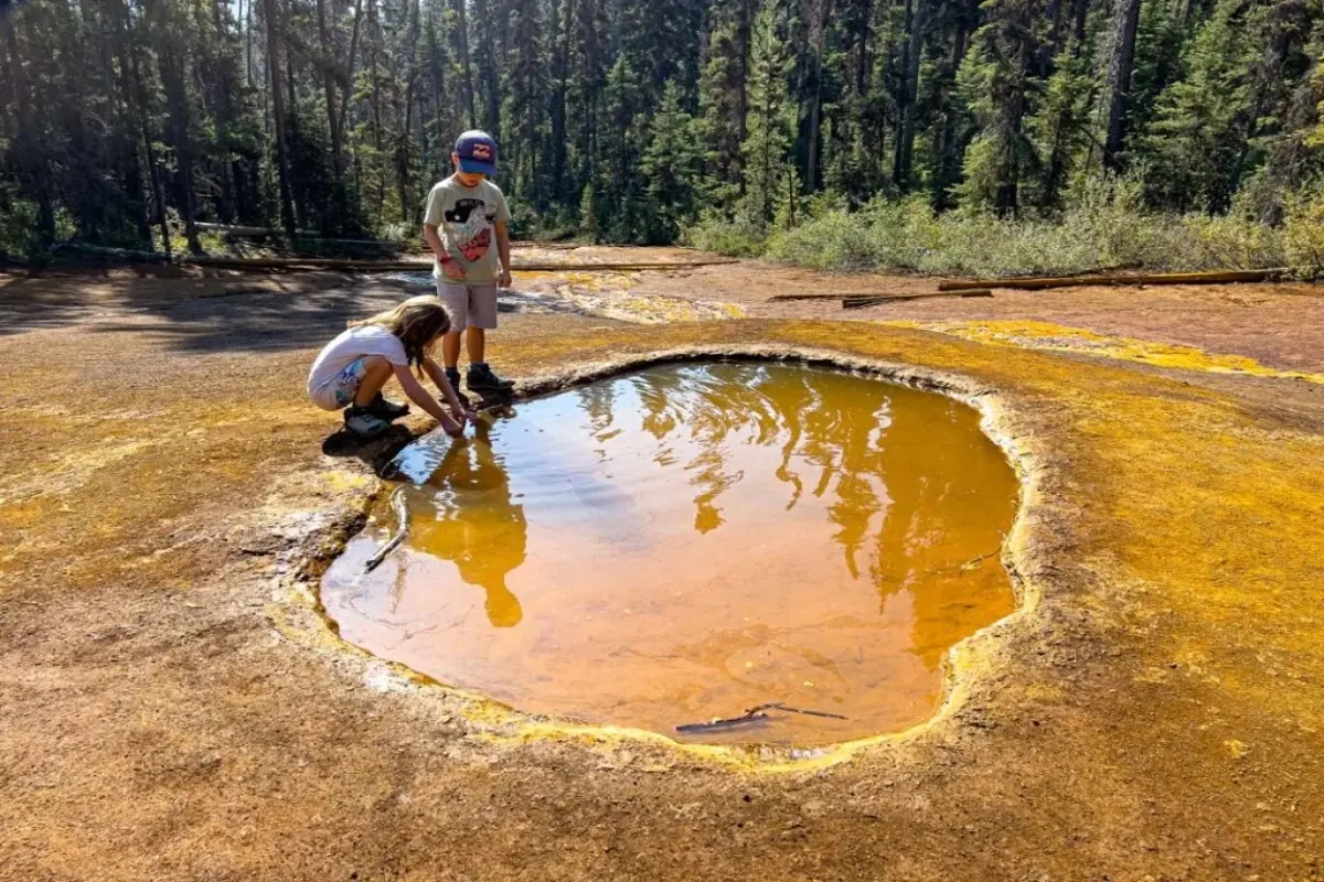
The Paint Pots are three iron-rich mineral springs that stain the ground deep orange and ochre. Ktunaxa people gathered this ochre long before the park existed. It’s an easy, flat walk across a suspension bridge over the Vermilion River.
4. Stop at Numa Falls
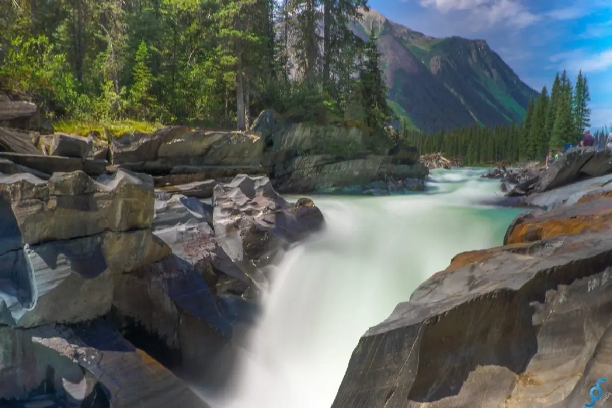
Numa Falls is a quick roadside stop where the Vermilion River squeezes through a rocky chute. Stay behind the railings, as the rock is slick.
5. Take in the Kootenay Valley Viewpoint
This pullout gives you one of the widest views in the park, looking across the Kootenay River valley to the Mitchell and Vermilion ranges.
6. Soak at Radium Hot Springs
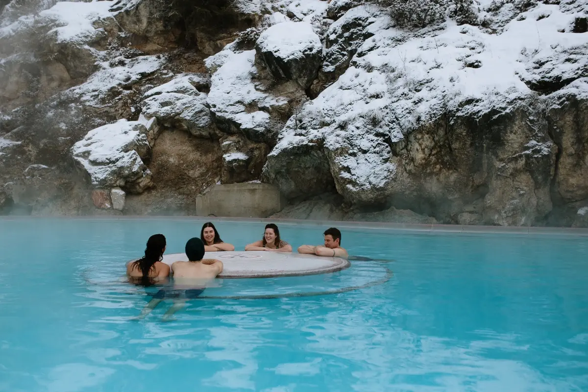
At the south end, Radium Hot Springs has a hot mineral pool and a cooler swimming pool tucked below the red cliffs of Sinclair Canyon. Pool hours and fees change by season, so check Parks Canada’s Radium Hot Springs before you go.
7. Olive Lake and Sinclair Canyon
Olive Lake has a short boardwalk along clear green water, and Sinclair Canyon has a moderate trail along the canyon rim. Both are good final stops if you’re asking what to see in the Kootenays before turning around.
Best Hikes in Kootenay National Park
With over 200 km of trails, Kootenay National Park hikes range from 15-minute strolls to multi-day treks. Let’s talk about the most popular Kootenay National Park trails.
| Trail | Distance (one way) | Elevation gain | Difficulty | Time (return) |
| Marble Canyon | 0.9 km | 65 m | Easy | 30 min |
| Paint Pots | 1 km | 35 m | Easy | 40 min |
| Stanley Glacier | 4.9 km | 405 m | Moderate | 3 h |
| Floe Lake | 10.8 km | 1,120 m | Difficult | 7 h or 2 days |
| Rockwall | 54.1 km | 3405 m | Difficult | 3 to 5 days |
So what’s the best hike in Kootenay National Park? For most people, it’s Stanley Glacier. You climb through a regrowing burn into a wide alpine basin, with meltwater pouring down huge rock walls. Fit hikers who want a full day usually rank Floe Lake among the best hikes in Kootenay National Park, for its lake below a sheer limestone wall.
When Can You Hike the Rockwall in Kootenay National Park?
The Rockwall is a 54 km backpacking route along a limestone cliff that rises up to 900 m above the trail. Its high passes usually stay snowbound until early to mid-July, and autumn snow can make it hard going by late September. Plan for mid-July to mid-September, and book backcountry campsites well ahead.
Kootenay National Park from Calgary and Banff
From Calgary, take the Trans-Canada Highway 1 west past Banff and turn onto Highway 93 South at Castle Junction. A Kootenay National Park day trip from Banff is easy, and from Calgary it’s a long but doable day. Keep these points in mind:
- Park pass: You need a valid Parks Canada pass. A Discovery Pass covers Kootenay, Banff, Yoho, and Jasper.
- No cell service: Download maps before you leave Banff or Radium.
- Visitor centre: The Kootenay National Park Visitor Centre is at 7556 Main Street East in Radium Hot Springs. Staff are on site from May to mid-October.
- Water rules: All lakes and rivers in Kootenay and Yoho are closed to watercraft and fishing until March 31, 2027.
- Drones: Recreational drones are banned in the park.
- Wildlife: Bighorn sheep, elk, and bears often graze near the highway. Pull fully off the road and follow our wildlife viewing ethics guide.
If you’d rather skip the driving, a guided tour handles the roads, passes, and timing so you can focus on the views.
What to Do Near Kootenay National Park
Not sure what to do near Kootenay National Park on the same trip? Easy pairings:
- Banff: Johnston Canyon and Banff town are 30 to 45 minutes away. See our easy hiking trails in Banff.
- Yoho: Emerald Lake and Takakkaw Falls are about an hour north. You can fully enjoy Yoho National Park tours.
- Golden: The Golden Skybridge suits a longer day.
- Lake Louise and Moraine Lake: You can also visit Lake Louise and Moraine Lake, which adds more excitement to your trip.
Explore the Rockies with Banff Trip Planner
Our Banff Top Lakes Tour & Banff Town picks up in Calgary, Canmore, or Banff and covers Lake Louise, Emerald Lake, and more in one day. Want Marble Canyon or the Paint Pots in your day? Our private tours let you shape the route, so contact us to ask about adding Kootenay stops.
Frequently Asked Questions About Kootenay National Park
1. Is Kootenay National Park worth visiting?
Yes. It’s quieter than Banff yet only 30 minutes away, and its top sights sit by the highway. Marble Canyon, the Paint Pots, and Radium Hot Springs make an easy day, while Stanley Glacier and Floe Lake reward hikers who want more.
2. What are the best things to do in Kootenay National Park?
Walk Marble Canyon, see the orange Paint Pots, stop at Numa Falls and the Kootenay Valley Viewpoint, and finish with a soak at Radium Hot Springs. In summer, add a day hike like Stanley Glacier.
3. How difficult is the hike to Marble Canyon?
It’s easy. It is 0.9 km one way with about 65 m of elevation gain, and most people finish the return walk in 30 minutes. In winter, the path gets icy, so wear ice cleats.
4. What are some fun things to do near Kootenay National Park?
Pair it with Johnston Canyon and Banff town, or head north into Yoho for Emerald Lake and Takakkaw Falls. Our Banff and Yoho tours cover many of these stops with pickup included.
5. What is the best hike in Kootenay National Park?
Stanley Glacier is the best all-round pick: about 3 hours return, moderate effort, and big glacier views. Strong hikers often choose Floe Lake, a steep 10.8 km climb to a lake below a towering limestone wall.